Examples of Presenting Political Map of Africa
If you need to add an African map to a PowerPoint slide then the following map templates collection can help you to design your slides. This post shares few ideas how you can present macroeconomic country statistics and other geographical map presentation examples.
The map of Africa depicts the various countries of the continent and the international boundaries.
(get a full vector map collection here)
The Africa Maps are accompanied with graphical elements you can use to make your presentation more interesting – such as handdrawn arrows and various pins.
Check our recent blog, where we share a few ideas on how you can create a good-looking map slide.
Why use the Africa template set?
Some common problems you can face while searching for various industry sectors images are:
- Hard to find a whole blank map or pull out a particular state out of it
- The inconsistent look of slides if you use several resources
- Unclear legal rights for using the map templates from the Internet, e.g. author attribution is needed, or templates are only for non-commercial private use.
- Maps may not be editable in PowerPoint
- Images of lower visual quality (distorted edges)
With our infoDiagram Maps of African Countries set, we address all those issues. Check the example slides below.
Examples of PowerPoint maps visualization
There are dozens of slides and presentations where you can apply maps for better visualization. Here are few variants of using maps together with some icons.
Show certain countries
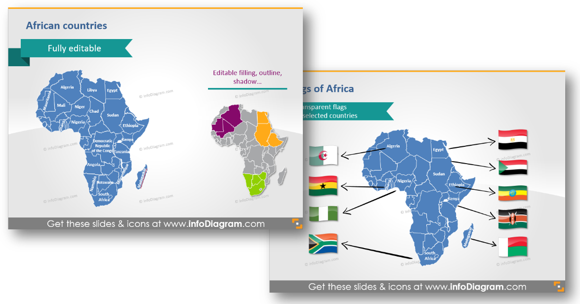
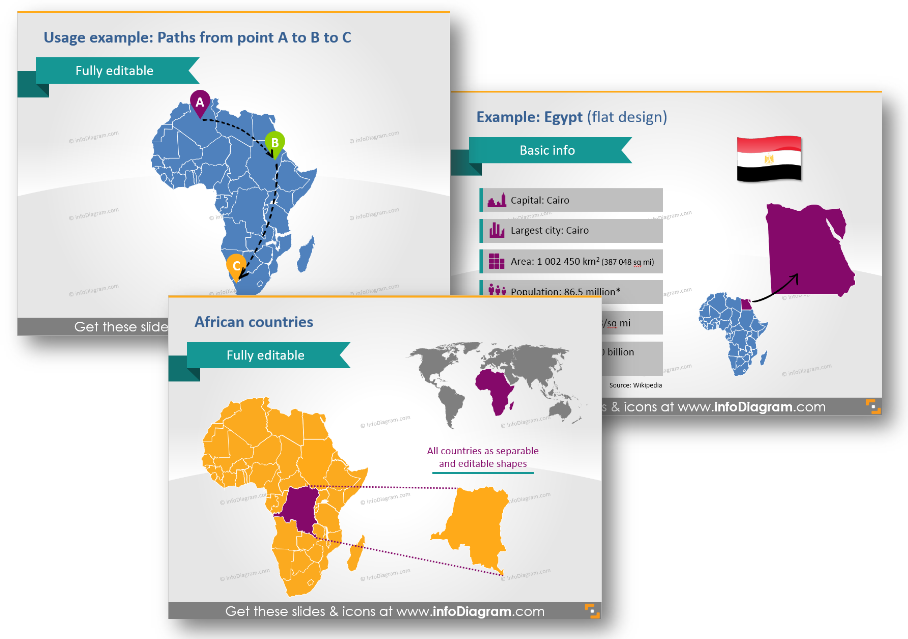
If you need to present certain countries on the African map, here’s a design tip how you can easily do it: distinguish them by color or flags and arrows.
Present countries on the world map
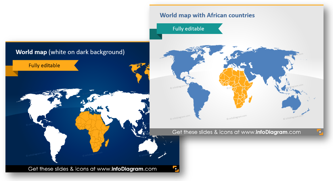
Show African countries on the world map. You can add icons or flags if needed.
Add pins and flags to indicate a place
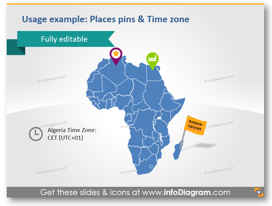
If you want to outline a particular city, region or show the time difference a good idea is to use icons, which can be easily edited. You can change size and color and add a flag or symbol, which will characterize the main activity of a city.
Draw transportation routes
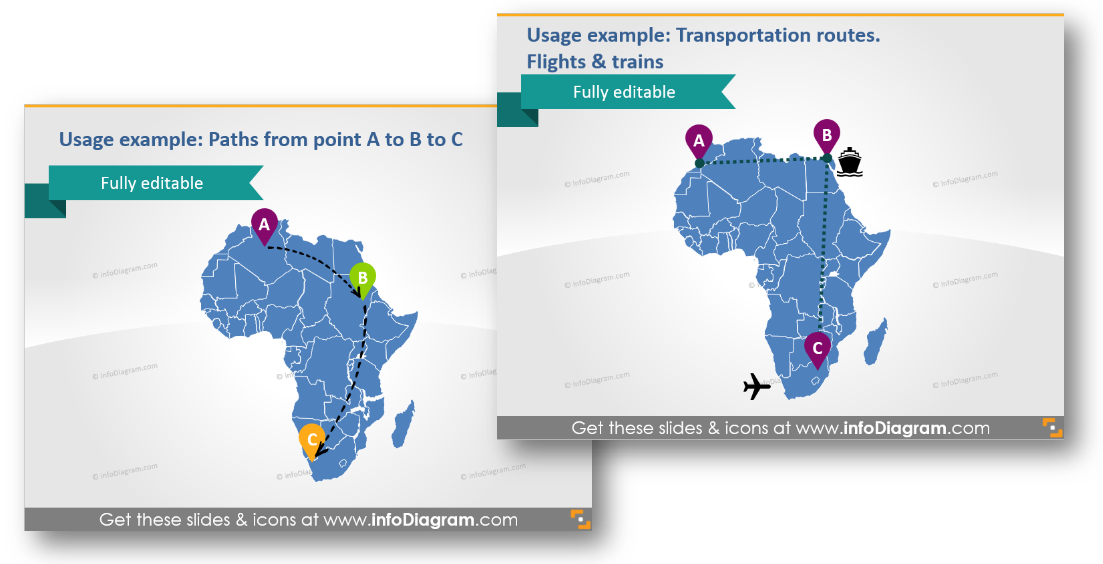
Here’s a variant of how you can show new transport routes and ways of transport in particular. The graphics set also contains transportation icons (truck, train, plane, ship, bus, lorry), production, distribution, and retail symbols for illustrating logistic routes on the Africa map.
What does the African Countries Maps set contain?
The collection consists of modern, flat symbols which are all presented as editable vector artwork so you can adjust them as needed, using standard PowerPoint tools. And they remain razor sharp also if you resize them, unlike bitmap pictures. You can choose colors to correspond with your brand, the color scheme and the layout of your presentation, or create natural-looking icons with numerous colors.
The Africa map and icon collection consists of:
- Maps of 54 African countries and world
- Icons for showing localization and logistics on maps:
- Pins and flags for indicating a place
- Hand drawn arrows for showing routes and journeys
- Transportation icons: Truck, Train, Plane, Ship, Bus, Lorry for illustrating logistic routes on the Africa map
- Production pictograms: Factory icon, Production facility icon, Production gears icon
- Distribution pictograms: Distribution center icon, Wholesale icon, Consumption Retail shop icon
- City pictogram: Capital icon, a Big city icon
- Examples of PowerPoint maps visualization:
- Places pins and indicating the time zone
- Routes from point A to point B and C in Africa (as handwritten arrows on a map)
- Transportation routes: flights and trains between the countries
- Country statistics data: Population, Density, Area, GDP, Largest city, Capital
- World map with Africa highlighted
You will also find a list of all countries of the African continent.
All map templates and icons above are from our infoDiagram PowerPoint Diagrams collection. It contains localization, logistics symbols and African maps, which can be easily edited and added to other presentation.
If you want to get more maps – check this Bundle of World Maps PPT Template – with over 200 editable PowerPoint maps of continents and countries. It includes also African countries graphics presented above.